In November 2022, I co-founded biometrio.earth with colleagues from Mexico and Germany to be the most reliable partner for biodiversity assessment and monitoring, actively shaping the transition to a sustainable economy. biometrio.earth provided its customers with reports about their local project ecosystem's condition. Our customers were in the (controversial) voluntary carbon market, in its biodiversity aspect, being either buyers, sellers, project developers, or those who wanted to get returns on their investments in this market.
I had the main title of technology lead and joined teams that required technology expertise. My roles included software architect, developer, engineer, data scientist, and engineer.
We operated as a data-as-a-service (DaaS) provider by collecting and processing information from various sources. We generated products ranging from PDF reports to access to our analytics dashboard. This allowed us to solve one of our customers' needs for insightful analytics regarding their project's biodiversity.
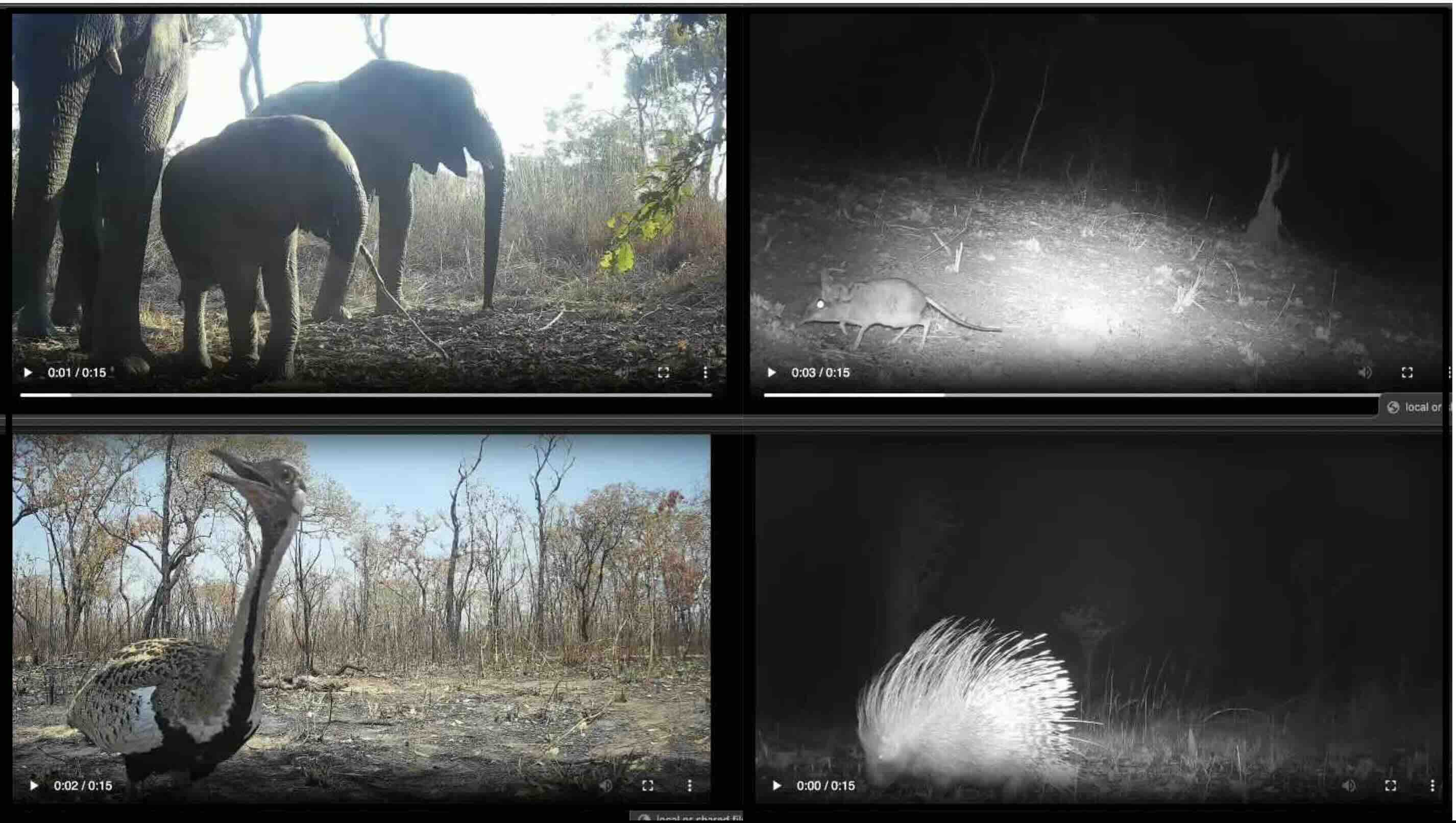
Some examples of the camera trap image and video data that were collected can be seen below:
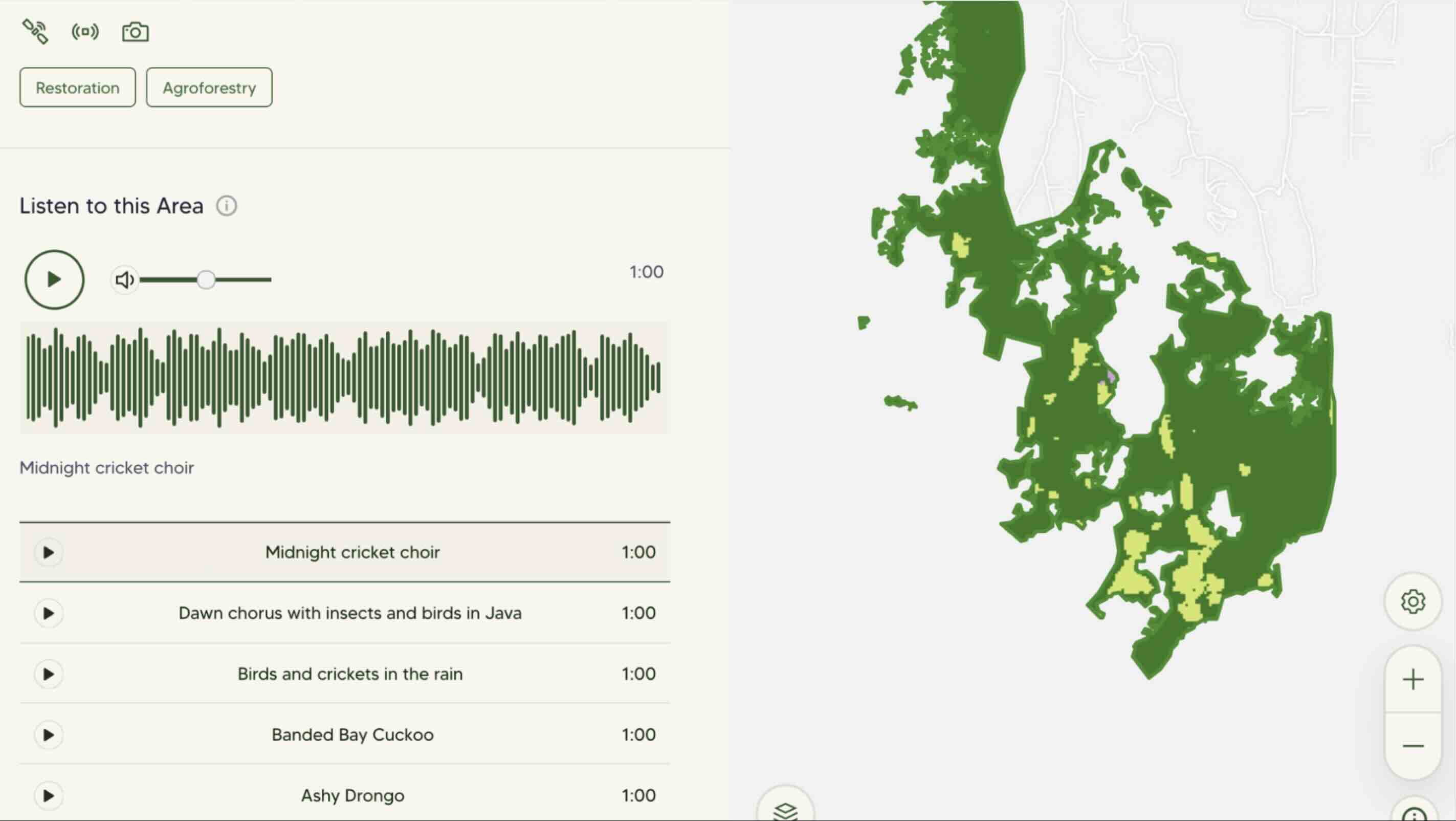
Audio data was one of the most complex datasets to process and analyse due to the large amount of information that we received every month in the project lifecycle. Every delivery from one recorder generated around 35 GB when recording every day from a month. This required scalable data processing pipelines in a microservices architecture. Below you can hear and watch spectrogram videos from 2 different locations.
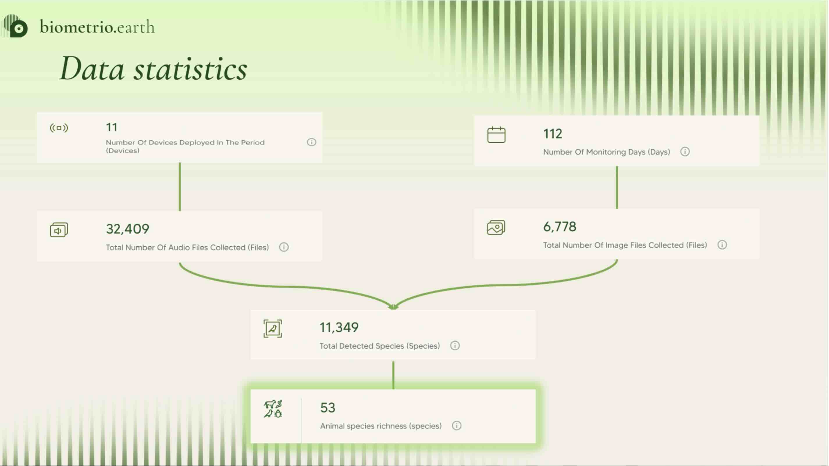
From all the data processing we reported:
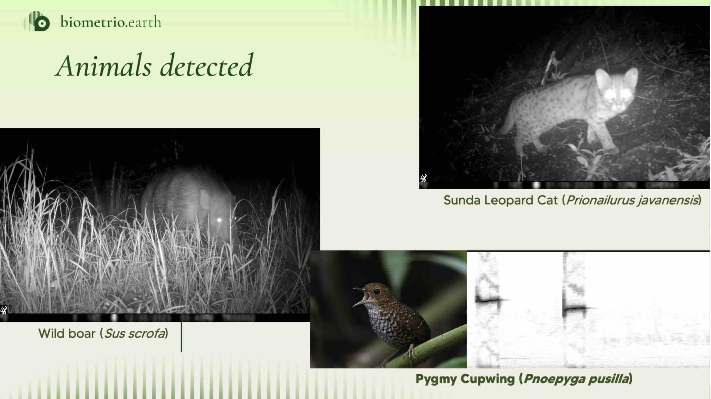
We utilised artificial intelligence (AI) and machine learning (ML) processing pipelines to identify the animals captured by sensor installed in the field. We used AWS cloud computing for the data processing and service deployment. To see more about my technology knowledge go to: technology
We signed long-term contracts with WWF and TreeO. We partnered with CreditNature and we became the new PlanVivo Foundation monitoring provider.
Due to financial challenges, biometrio.earth decided not to continue with the business. Nevertheless, their members and I learnt a lot from this experience. In particular, I learnt to put into practice leadership skills and gained more experience in software architecture, development, and engineering.
CONABIO stands for Comisión Nacional para el Conocimiento y Uso de Biodiversidad (National Commission for Knowledge and Use of Biodiversity). It was founded in 1992 by presidential decree. Its main activities relate to:
I worked as a geospatial software developer and engineer in the MAD-Mex project for producing land cover and land cover change maps at a national scale using satellite imagery.
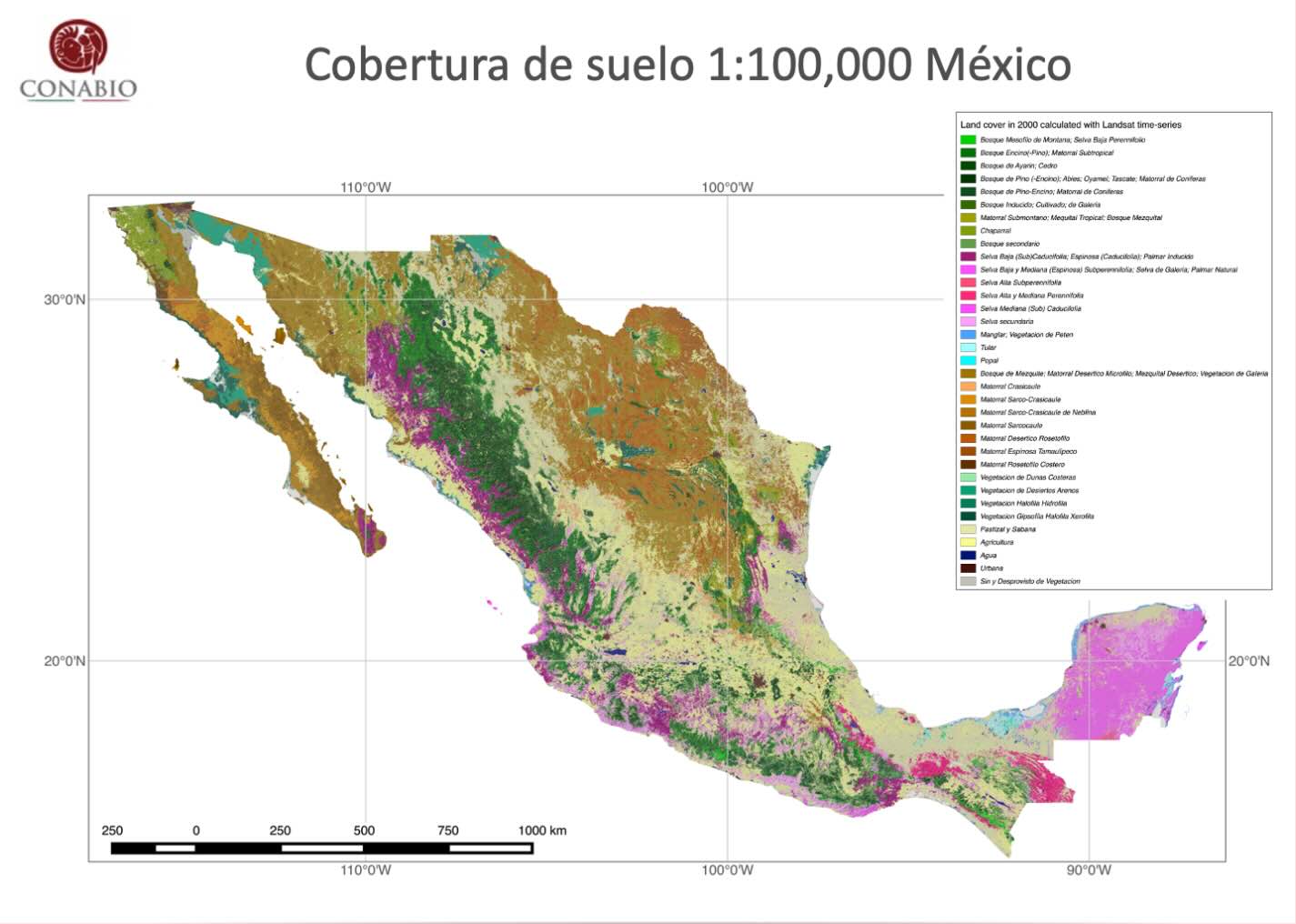
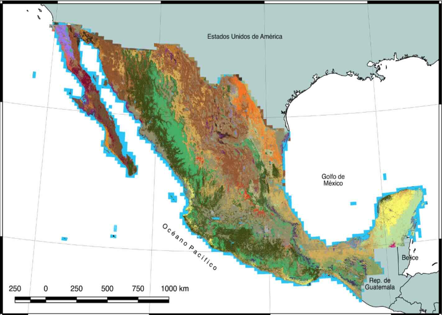
The first map is a LANDSAT land cover from the year 2000 with 32 classes from INEGI. The second map RapidEye land cover, 2015 year with 32 classes from INEGI. Training data for both maps used INEGI time series.
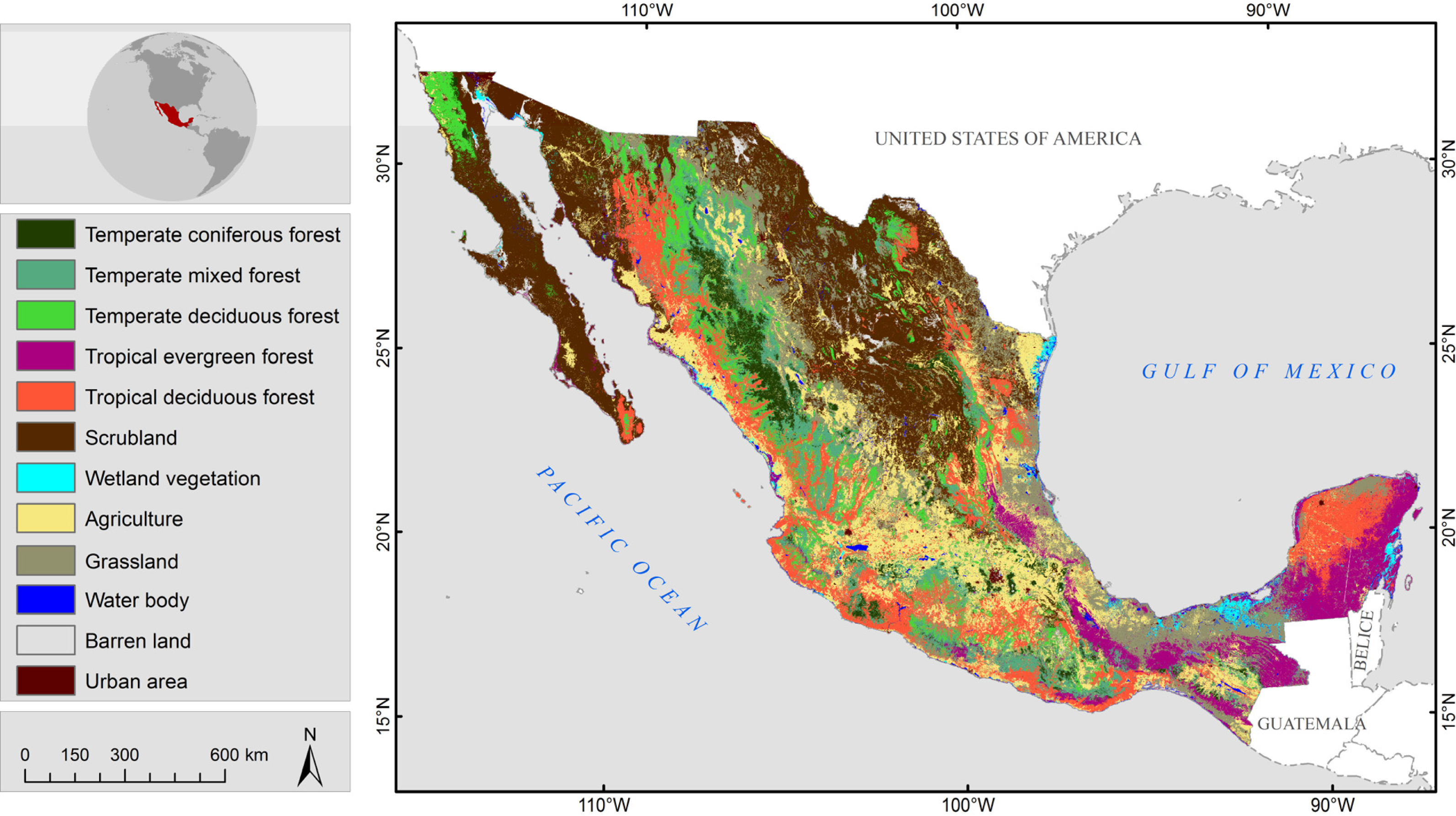
Here's one of the land cover maps produced in this project for the Lacandona region in the Chiapas state in the southeast of Mexico. It is a land cover map from 2015 using RapidEye images with INEGI training data time series aggregated to 9 classes.
For product generation we used ASTER, DEM/Slope, ESA WorldCover, Landsat, RapidEye, and Sentinel datasets. Training data used INEGI time series.
We utilised artificial intelligence (AI) and machine learning (ML) processing pipelines to generate land cover maps. The software package antares3 was released for producing these land cover maps. We used AWS cloud computing for the data processing and service deployment. To see more about my technology knowledge go to: technology
Part of my responsibilities were conducting and facilitating workshops in Latin American regions for training people with partnerships with CONABIO and other Mexican institutions.
My time at CONABIO provided me with hands-on experience in software development, data processing, and environmental conservation.
Founded in 1946, ITAM is positioned among the best Mexican technology institutions for its students, professors, and research work.
One of my main desires was to share what I learnt as a student and return what ITAM's faculty taught me. Therefore in 2013 I started working as a lecturer while I was still a master's student.
I enjoyed my time at ITAM doing math proofs as both a student and lecturer. Here's a simple proof for ellipsoids (convex sets) and symmetric positive definite matrices. I then used my convex notes to write an electronic textbook for the data science master’s degree courses at ITAM.
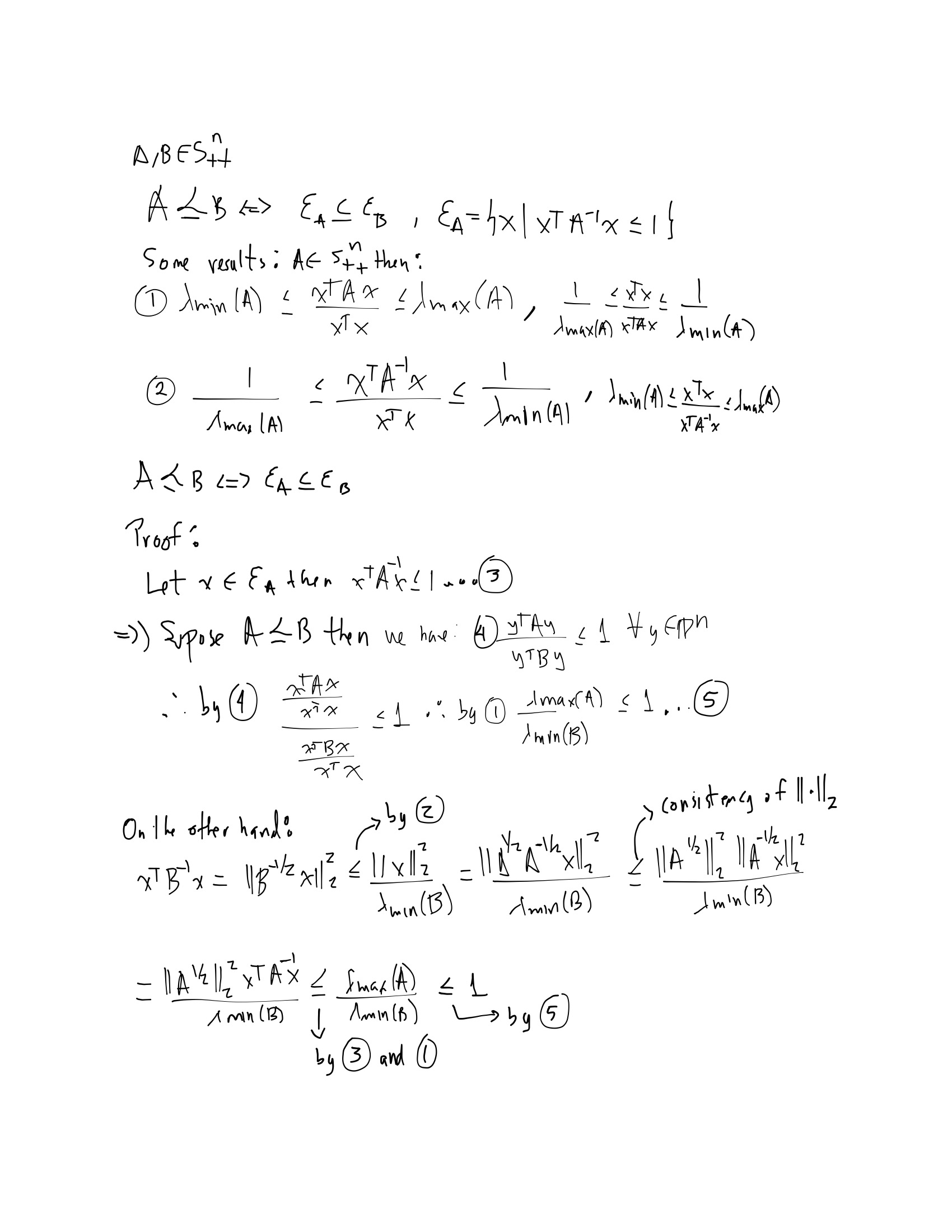
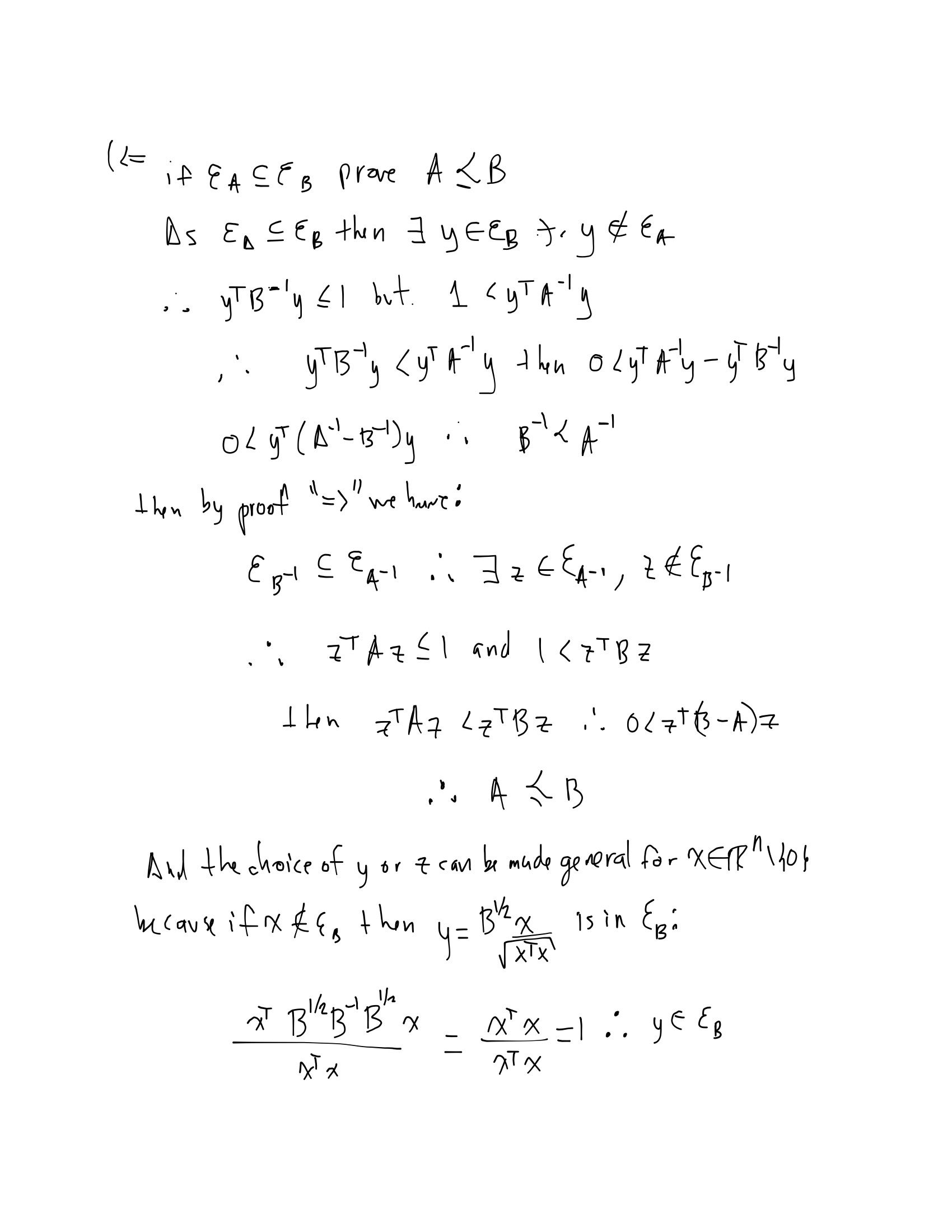
Here's an extract of the textbook I wrote when I was a lecturer. It is available in link and it contains my 10 years of being a lecturer and my 5 years as a bachelor and master's degree student. It is a numerical optimization textbook with an engineering focus.
As part of the data science master's degree initiatives, ITAM decided to found ITAM’s data center back in 2015. Its main goal was to invite students in data science for projects with social impact. I collaborated with it during the 2021-2022 years as an engineer lead on two projects with a social perspective. In one of the projects, artificial intelligence (AI) and machine learning (ML) technologies were used to analyse textile design patterns from indigenous people and to detect if commercial companies were using them. The other analyzed images published in digital newspapers and social media about climate change over the last 20 years. The Git repositories are hosted in kemtil, nanook and the software infrastructure we used is in: kube_cdas In the data center we used AWS cloud computing for the data processing and service deployment.
During my 10 years as a lecturer, I taught courses about:
Here I list some of my personal projects, which I continue improving while I enjoy learning new tools and technologies:
I believe all tech projects should have the OAuth 2.0 authorization code flow. This cybersecurity feature could be enabled according to each project's context. Therefore as part of my OAuth authorization code learning, I implemented a simple API call from a frontend.
I wanted to call an open-source model served by Ollama securely behind an Nginx and OpenID Connect from a local deployment to better understand compute requirements and where we are in this topic. I believe the LLMs are promising models that will definitely enhance our work if used responsibly. In this example I'm using a small model, llama3.2.
I still remember when I got my first mobile and I played the snake's game and spent lots of time trying not to hit the snake's tail. Mobile phones have evolved a lot, but my interest was declining due to using them more as gaming or computer devices than for talking with people (which a phone's functionality should be in the 1st place) and their current disposability. Nevertheless, I developed mobile apps when working for both CONABIO and biometrio.earth, and my interest rose again. Therefore I learnt two mobile programming languages (Dart and Kotlin) to develop the "DogVentures" mobile app. This app is an image and video organizer for my beloved dog Kale, from whom I have a good amount of images and videos. My mobile just gets filled up pretty quickly with images and videos, and I don't know where they are anymore, which frustrates me!